Challenge
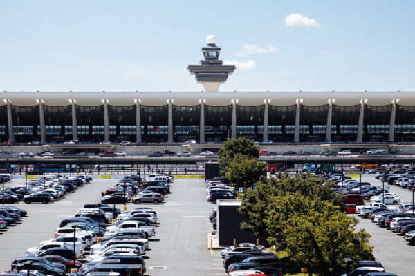
High‑injury intersections and corridors account for a disproportionate share of serious and fatal crashes, but agencies lack tools that are fast, flexible, and comprehensive. A small part of the network drives most vehicle, pedestrian, and cyclist collisions—often caused by speeding, red‑light running, and aggressive maneuvers during peak and late‑night hours when staffing is thin. Complex layouts create blind zones that prevent officers or fixed cameras from seeing the full conflict area.
Police leadership faces growing pressure to deliver measurable safety improvements at specific high‑risk locations. Vision Zero commitments and public scrutiny demand results, while traditional solutions—permanent infrastructure, fixed cameras, and labor‑intensive enforcement—are slow, costly, difficult to relocate, and provide incomplete data. As crash patterns shift, agencies are left without clear, before‑and‑after evidence of what works where risk is highest.
Solution
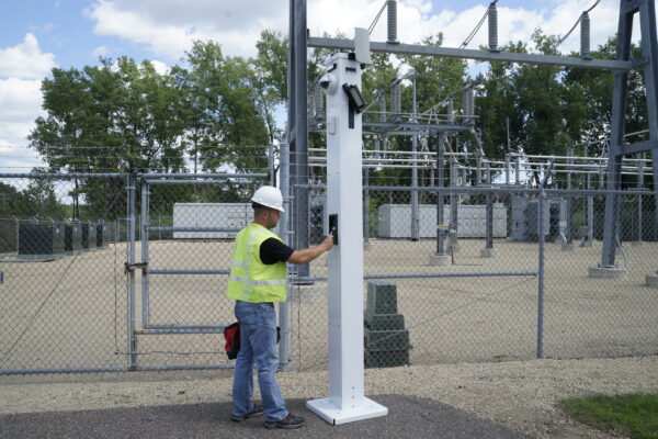
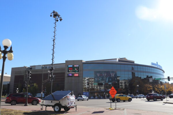
To close these gaps, departments deploy Mobile Pro Systems platforms to high‑injury intersections and corridors as a fast, flexible layer of visibility and enforcement support.
Elevated Sentry platforms capture the area in a single view, including high‑speed approaches, stop‑bars, crosswalks, bus stops, and adjacent driveways. Along high‑risk corridors, trailers are placed where speeding and lane‑change behavior have caused recurring rear‑end and sideswipe crashes, then repositioned over time to follow enforcement waves or engineering changes. In both settings, the platforms provide a visible 24/7 presence while capturing evidence‑grade video of driver behavior before, during, and after interventions.
Video and data integrate with the systems Chiefs already use, including VMS, CAD, and—where appropriate—ALPR and analytics. Supervisors can assess conditions at complex locations before deploying units, identify patterns such as late‑yellow runs or pedestrian conflicts, and target enforcement and engineering where it will have the greatest impact.
Result
Over a 6–12 month period, agencies using camera‑supported enforcement and visibility at high‑risk locations commonly see double‑digit percentage reductions in speeding, red‑light running, and crash indicators at treated sites. In Chicago, for example, intersections with red‑light cameras experienced roughly a 25 percent reduction in collisions and a 21 percent decrease in harsh‑braking events, while evaluations of automated speed enforcement in Washington, D.C. and other cities have documented statistically significant safety benefits on treated corridors. Taken together, published research supports a conservative, defensible claim that well‑placed, camera‑supported deployments at high‑injury intersections and corridors often produce on the order of 20–30 percent improvements in key safety metrics when sustained over time and paired with appropriate enforcement and engineering.
Supervisors can check conditions at complex intersections before assigning officers, reduce the need for standing posts on high‑speed approaches, and focus traffic safety details where live and recorded video show the greatest risk. Over time, fewer blind deployments into busy, multilane environments are needed, and officers arrive with better situational awareness from recent footage.